

Introduction
Urban analysis is the backbone of modern city planning. As cities expand and populations surge, understanding urban dynamics becomes crucial. Urban analysis examines how various factors—social, economic, and environmental—interact within city environments.
But why is this significant? Well, it helps planners forecast needs, optimize resource allocation, and create sustainable policies. It’s the magic wand that turns data into actionable insights for urban developers and policymakers.
Statistics play a vital role in urban analysis. Think of statistics as the GPS that guides urban planners through the maze of urban data. From data collection to analysis and interpretation, statistics provide the tools necessary to make informed decisions. Planners use statistical methods to analyze demographics, housing markets, and environmental factors.
In this article, you’ll discover how statistics are integrated into urban analysis classes. We’ll cover the essential statistical concepts, tools, and techniques that aspiring urban planners need to master. Whether you’re a student or simply curious about urban planning, this guide will illuminate the importance of statistics in shaping our cities.

Understanding Urban Analysis
What is Urban Analysis?
Urban analysis is an interdisciplinary field that evaluates the complexities of urban spaces. At its core, it focuses on understanding the dynamics of cities, including population distribution, economic activities, and environmental impacts.
This analysis encompasses various dimensions, including spatial patterns, social dynamics, and economic factors. By dissecting these elements, urban analysts can provide valuable insights into the functioning of cities. For instance, understanding how public transportation affects urban growth can lead to informed decisions about infrastructure investments.
Moreover, urban analysis is fundamental for policy-making. When local governments craft policies, they rely on accurate data to address real-world issues. Whether it’s tackling traffic congestion or improving public health services, urban analysis equips planners with the necessary evidence to support their recommendations.
In sum, urban analysis is not just about numbers; it’s about understanding the heartbeat of a city. By revealing patterns and trends, it enables planners to create more livable, efficient, and sustainable urban environments.

Key Components of Urban Analysis
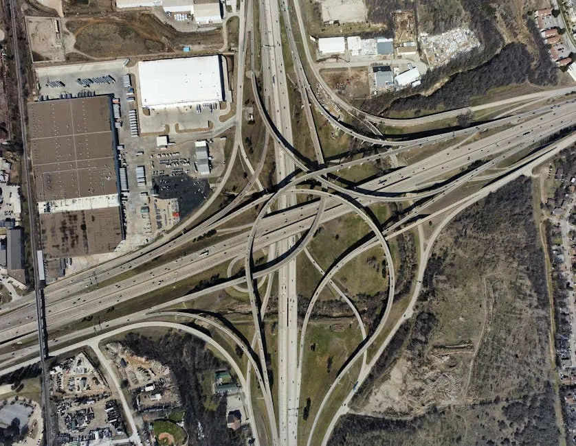
- Spatial Analysis: Understanding spatial relationships is like playing a game of connect-the-dots with urban landscapes. Spatial analysis examines how different elements, like roads, buildings, and parks, relate to each other. It helps identify patterns, accessibility, and how space is used. Techniques such as Geographic Information Systems (GIS) Software allow urban planners to visualize this data effectively. By analyzing spatial relationships, planners can optimize resource allocation and enhance urban designs.
- Social and Economic Analysis: Urban areas are buzzing with social dynamics and economic activities. Social analysis focuses on understanding demographics, cultural diversity, and community interactions. It reveals how different groups coexist and interact within urban settings. Economic analysis, on the other hand, investigates employment trends, income distribution, and market activities. Together, these analyses help urban planners create inclusive policies that address social inequalities while stimulating economic growth.
- Environmental Analysis: Environmental analysis assesses how urbanization impacts the natural world. It evaluates air quality, green spaces, and water resources. Understanding these impacts is crucial for promoting sustainability. Urban planners use this analysis to develop strategies that mitigate negative environmental effects. For instance, knowing which areas suffer from poor air quality can lead to targeted interventions, like planting more trees or improving public transport.
Real-World Applications
Urban analysis projects showcase the practical application of statistics in decision-making. Take a city that wants to reduce traffic congestion. Planners can analyze traffic patterns using statistical methods to identify peak hours and congested routes. By visualizing this data, they can propose changes, such as adding bike lanes or optimizing traffic signals.
Another example is urban renewal initiatives. By studying demographic shifts and economic activities, planners can revitalize underperforming neighborhoods. They can pinpoint areas needing investment, ensuring that funds are directed where they’ll have the most impact. If you’re looking for a comprehensive resource on this, check out Urban Renewal: A Guide to Revitalizing Communities.
Statistics are also crucial in disaster management. Cities often use data to develop evacuation plans, ensuring public safety during emergencies. Analyzing historical data on natural disasters helps planners understand vulnerabilities and better prepare for future events.
In essence, urban analysis transforms data into actionable insights. It empowers cities to make informed decisions, ultimately leading to more livable and sustainable urban environments.

Statistical Foundations
Types of Data in Urban Analysis
- Quantitative vs. Qualitative Data: Quantitative data is all about numbers. It includes measurable aspects like population size and income levels. For instance, census data provides a wealth of quantitative information that can illustrate a city’s demographic shifts over time. On the flip side, qualitative data captures the essence of urban experiences. Think interviews, focus groups, or observations that reveal how residents feel about their neighborhoods. Together, these data types create a complete picture of urban life.
- Data Sources: Urban analysts have a treasure trove of data sources at their disposal. Census data is a key player, offering insights into population trends and demographics. Surveys also play a vital role, gathering public opinions and preferences. Satellite imagery provides a bird’s-eye view of urban development, revealing patterns in land use and environmental changes. By harnessing these diverse data sources, urban analysts can create informed strategies to tackle complex urban issues.

Descriptive Statistics
Understanding urban dynamics starts with descriptive statistics. They summarize data, making it easier to understand complex urban environments. Let’s break it down into three critical components: measures of central tendency, measures of dispersion, and data visualization.
Measures of Central Tendency: Here we have the mean, median, and mode. The mean is the average of a dataset, perfect for overall insights. The median provides the middle value, which is helpful when there are outliers. Lastly, the mode tells you the most frequently occurring value, giving a glimpse into common trends.
Measures of Dispersion: This includes range, variance, and standard deviation. The range shows the spread between the highest and lowest values. Variance reveals how much data points differ from the mean, while standard deviation indicates how spread out the values are. Together, these measures tell a story about the variability of urban data.
Data Visualization: Visuals like charts and graphs are essential for urban data. They transform raw numbers into digestible formats. Whether it’s a bar chart showing population growth or a line graph for housing prices, visuals make complex information accessible. They help city planners make informed decisions quickly, ensuring that no crucial data point goes unnoticed. For more insights on data visualization, consider checking out Data Visualization with Matplotlib: A Practical Guide.

Data visualization is a powerful tool in urban analysis, as it helps in interpreting complex datasets. For more on this topic, check out this comprehensive guide on descriptive statistics in manufacturing plant.
Inferential Statistics
Now, let’s take a step into inferential statistics. This branch helps us make predictions and draw conclusions from samples of data, which is vital for urban analysis.
Hypothesis Testing: The purpose here is to determine if there is enough evidence to support a particular claim about the urban population or trends. For example, if we want to know whether a new park reduces traffic congestion, we can set up a hypothesis test. This involves formulating a null hypothesis (no effect) and an alternative hypothesis (an effect exists). By analyzing data, we can conclude whether to accept or reject the null hypothesis, guiding policy decisions.
Regression Analysis: This technique is used to predict urban trends. Linear regression looks at the relationship between two variables, such as income and housing prices. Meanwhile, multiple regression involves several variables, providing a more comprehensive view of factors influencing urban development. For instance, it can help forecast how changes in employment rates and transportation availability affect residential patterns.

Software Tools for Statistics
When it comes to urban analysis, the right software tools can make all the difference. Programs like Statistical Analysis with R: A Beginner’s Guide, Python for Data Analysis: Data Wrangling with Pandas, and STATA: The Complete Guide for Beginners are popular among urban analysts.
R is fantastic for statistical analysis and visualization. It has a vast array of packages that make it easy to manipulate data and generate stunning graphics. Python, on the other hand, is great for more than just statistics; it’s versatile for data manipulation and web scraping too.
STATA stands out for its robust statistical capabilities, especially in econometrics. It’s user-friendly and perfect for those who prefer a straightforward interface.
Statistical software is crucial for efficiently analyzing large datasets. It enables urban analysts to uncover trends, visualize data, and derive insights faster. Without these tools, navigating the complexities of urban data would be like trying to find a needle in a haystack.

Advanced Statistical Techniques in Urban Analysis
Spatial Statistics
Geospatial Analysis
Geospatial analysis is the secret sauce of urban analysis. It helps to visualize and interpret spatial data. With techniques like GIS for Urban Planning and Management and remote sensing, analysts can map out urban patterns like a treasure map.
Imagine using GIS to identify areas with inadequate public transportation. Analysts can layer data—like population density and transportation routes—to see where improvements are essential. This technique highlights accessibility issues, ensuring residents can easily reach jobs, schools, and healthcare.
Moreover, geospatial analysis can detect land use changes over time. By comparing historical data with current maps, planners can identify trends like urban sprawl or increased green spaces. This insight aids in making informed decisions about zoning regulations and resource allocation.
Lastly, geospatial analysis also integrates socio-economic data. By visualizing income levels alongside crime rates, planners can target interventions effectively. For instance, if certain neighborhoods show a spike in crime, resources can be funneled into community programs or increased policing.

Spatial Autocorrelation
Spatial autocorrelation is another crucial technique. It measures the degree to which a set of spatial data points correlates with one another. Why is this important? Because urban phenomena often exhibit clustering. For example, high crime rates in one area might affect neighboring zones.
Understanding these spatial relationships helps urban planners craft better policies. For instance, if crime is clustered in specific neighborhoods, targeted interventions can be developed. This might involve community engagement programs or increased law enforcement presence.
Moreover, tools like Moran’s I or Getis-Ord Gi* can quantify these relationships. By calculating these indices, analysts can identify hot spots or areas needing attention. The result? A more strategic approach to urban planning that enhances safety and livability.

Machine Learning and Predictive Modeling
Introduction to Machine Learning
Machine learning is the cool kid on the block in urban analysis. This technology enables the analysis of vast datasets, revealing patterns that traditional methods might miss. But what does it mean for urban analysis?
Simply put, machine learning allows analysts to predict future trends. By training models on historical data, planners can forecast housing demands, traffic flows, and even economic shifts. This predictive power is invaluable for proactive urban planning.
Imagine a city using machine learning to optimize waste collection routes. By analyzing data on population density and waste generation, cities can streamline operations, saving time and resources.

Applications of Machine Learning
The applications of machine learning in urban planning are numerous. For instance, predictive modeling can assess the impact of new developments on traffic patterns. By inputting various development scenarios, planners can visualize potential congestion issues before they arise.
Another exciting use is in public health monitoring. Machine learning can analyze health data alongside environmental factors, identifying areas at risk for outbreaks. This allows for timely interventions, enhancing community wellness.
Moreover, cities are increasingly adopting machine learning for smart traffic management. By analyzing real-time traffic data, algorithms can adjust signal timings, reducing congestion. This leads to smoother commutes and less pollution—who wouldn’t want that?

Case Studies
Several case studies illustrate the power of advanced statistical methods in urban analysis. Take New York City, for example. By employing spatial statistics and machine learning, city planners optimized public transportation routes. This initiative increased ridership and improved access for underserved neighborhoods.
Another notable case is Los Angeles, where predictive modeling was used to analyze housing trends. The city leveraged machine learning to predict future housing needs based on demographic shifts. This foresight allowed for better zoning decisions and resource allocation.
Additionally, cities like Amsterdam have utilized geospatial analysis to enhance their cycling infrastructure. By mapping cycling routes and accident hotspots, planners developed safer, more efficient bike lanes. To dive deeper into urban design strategies, check out The Complete Guide to Urban Design.
These case studies demonstrate how advanced statistical techniques can significantly impact urban analysis outcomes. They highlight the importance of data-driven decision-making in creating sustainable, livable urban environments.

Challenges in Urban Data Analysis
Urban data analysis faces several challenges. One major issue is data quality and access. Many cities struggle with incomplete or outdated datasets. Without reliable data, making informed decisions becomes difficult.
To tackle these issues, cities must invest in data collection and management practices. This might involve modernizing data infrastructure or collaborating with tech firms to enhance data accuracy.
Another challenge is the interpretation of results. Urban planners must be equipped with the critical thinking skills necessary to analyze complex datasets. Misinterpretations can lead to poor policy decisions, negatively impacting communities.
Moreover, ethical considerations surrounding data privacy are paramount. Planners must ensure that data collection practices respect individual privacy rights while still providing valuable insights.
By addressing these challenges, urban analysts can navigate the complexities of urban data analysis more effectively. This will ultimately lead to better-informed planning decisions that benefit all city residents.

Data Quality and Access
Navigating the world of urban statistics can feel like walking through a maze blindfolded. One of the biggest hurdles? Data availability. Many cities are sitting on heaps of data, but accessing it is often akin to pulling teeth. Outdated datasets or incomplete records can lead to skewed analyses. And let’s not forget privacy concerns. With strict regulations like GDPR, urban analysts must tread cautiously when handling personal information.
So, how can we tackle these data-related challenges? First, cities should invest in modern data management systems. This ensures real-time access to reliable datasets. Collaborating with tech companies can also help streamline data collection processes. Open data initiatives can promote transparency, encouraging citizens to share their data while maintaining their privacy.

Interpretation of Results
Interpreting statistical outputs isn’t just about crunching numbers—it’s an art that demands critical thinking. Analysts must scrutinize their findings, asking questions like: “What does this data really mean?” or “Could there be hidden biases?” This level of analysis is vital for drawing accurate conclusions. After all, no one wants to base decisions on faulty data!
Ethical considerations play a huge role here too. Presenting statistical analyses requires honesty and integrity. Misrepresenting data can lead to misguided policies, damaging communities. Urban planners must adhere to ethical standards, ensuring their analyses are both clear and truthful. By doing so, they uphold the trust essential for effective urban planning.
Conclusion
Statistics serve as the backbone of urban analysis. They provide the tools needed to understand complex urban environments. By employing rigorous statistical methods, urban planners can uncover trends and patterns that inform policy decisions. Remember, the accuracy of these analyses directly impacts the quality of life in urban settings.
As cities evolve, so does the role of statistics in urban planning. With technological advancements, we can expect more sophisticated analytical tools. Predictive modeling and machine learning will likely become commonplace, allowing planners to foresee challenges before they arise. This proactive approach will lead to smarter, more resilient cities.
So, what can you do? Embrace statistics as a vital component of urban analysis. Whether you’re a student or a seasoned professional, honing your statistical skills can greatly enhance your urban planning efforts. Dive into online courses, engage with local data initiatives, and explore software tools to strengthen your expertise. After all, when it comes to shaping our cities, knowledge is power. If you’re looking for a comprehensive resource, check out The Data Warehouse Toolkit: The Definitive Guide to Dimensional Modeling.
FAQs
What statistical skills are most important for urban analysis?
A solid foundation in statistics is crucial for urban analysis. Key skills include understanding descriptive statistics, hypothesis testing, and regression analysis. Familiarity with data visualization techniques is also essential, as it helps convey complex information clearly. Additionally, knowing how to interpret statistical outputs critically will enhance decision-making in urban planning.
How can one improve their statistical knowledge for urban analysis?
Improving your statistical knowledge is easier than ever! Online platforms like Coursera, edX, and DataCamp offer courses specifically tailored to urban analytics. Textbooks on statistics and urban planning also provide valuable insights. Don’t forget to explore local workshops or community college courses that focus on data analysis and visualization techniques.
What software is best for beginners in urban analysis?
For beginners, user-friendly software like Excel and RStudio is highly recommended. Excel is great for basic data manipulation and visualization. RStudio, while a bit more advanced, offers extensive resources for statistical analysis and is widely used in academic and professional settings. Python is another excellent tool for those looking to dive deeper into data science.
Are there specific statistical methods commonly used in urban planning?
Yes! Commonly used statistical methods in urban planning include regression analysis, ANOVA, and time-series analysis. Regression helps predict the relationship between variables, such as income levels and housing prices. ANOVA allows planners to compare means across different groups, while time-series analysis tracks changes over time, assisting in forecasting urban trends. Understanding these techniques will significantly enhance your urban analysis capabilities.
Please let us know what you think about our content by leaving a comment down below!
Thank you for reading till here 🙂
All images from Pexels