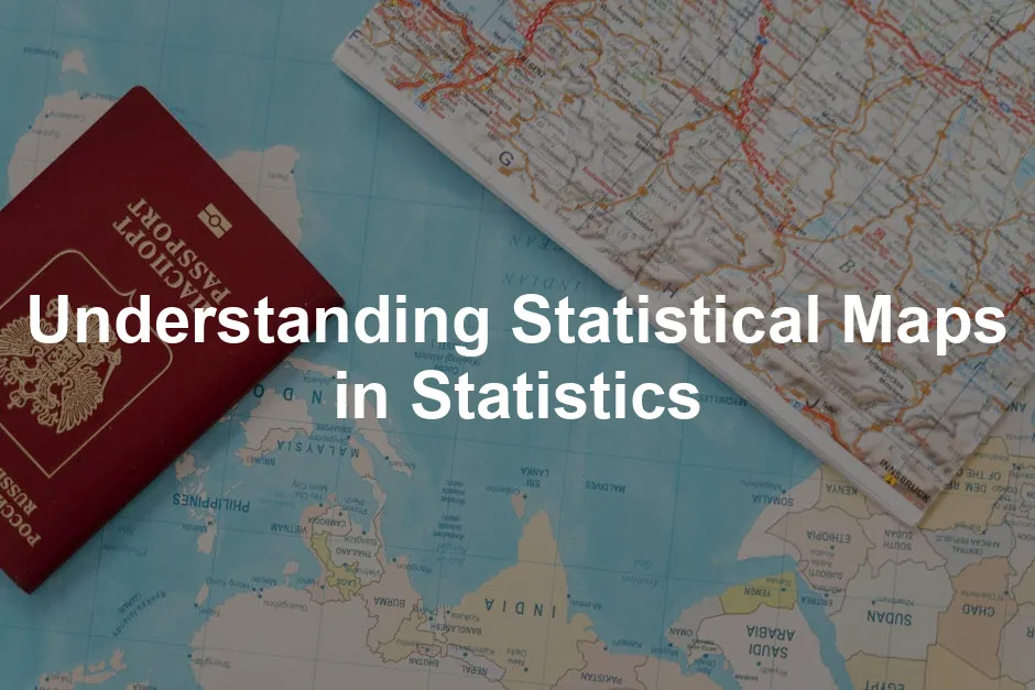
Introduction
Statistical maps are the unsung heroes of data visualization! They transform complex datasets into colorful, easy-to-understand visuals. Think of them as the friendly tour guides of statistics, showing us the fascinating stories hidden within numbers. From geography to economics and healthcare, statistical maps play a pivotal role in various fields, making data accessible and engaging. Why are these maps so important? Well, they give life to data, helping us see patterns, trends, and anomalies. Imagine trying to decipher a massive spreadsheet filled with numbers. It’s like trying to find Waldo in a sea of red stripes! Statistical maps simplify this process, allowing us to grasp complex information at a glance. In this article, we’ll navigate through the world of statistical maps. You’ll learn what they are, how they differ from traditional maps, and explore examples like choropleth and dot distribution maps. Get ready to unlock the secrets of statistical maps and discover how they can enhance your understanding of data. Let’s get started on this colorful journey!
1. What is a Statistical Map?
A statistical map is a visual representation of data that focuses on illustrating numerical values across geographic areas. Unlike traditional maps, which emphasize physical features like rivers and mountains, statistical maps prioritize the data contained within those areas. They help us see the bigger picture of how data varies across locations. Statistical maps come in various forms, each serving a unique purpose. For instance, choropleth maps use different shades or colors to represent data values. Imagine a map of the United States where states are colored based on population density. This visual instantly reveals which states are bustling with people and which are more sparsely populated. Dot distribution maps are another example. They use dots to represent the presence of a phenomenon, like the spread of a disease or the distribution of resources. Each dot could signify a specific number of occurrences, providing a visual sense of density. In summary, statistical maps are invaluable tools in statistics. They allow researchers, policymakers, and the general public to visualize data effectively. By transforming numbers into engaging visuals, statistical maps help us understand complex information in a way that resonates. So the next time you encounter a map, remember—it’s not just a map; it’s a window into the world of data!
2. Types of Statistical Maps
Statistical maps come in various forms, each with its unique flair. Let’s explore some popular types of statistical maps that make data shine and speak volumes.2.1 Choropleth Maps
Choropleth maps paint a vivid picture of data by using colors and shades to represent numerical values across geographic regions. Imagine a map of your city, where each neighborhood is filled with different colors indicating its population density. These maps allow us to visually grasp how data varies in different locations at a glance. Use cases for choropleth maps are plentiful. They shine in displaying population density, income levels, and even election results. For instance, a map showing states in the U.S. colored by median household income can reveal wealth disparities across the country. This visual representation makes it easier to identify areas of affluence and those in need. However, classification schemes play a critical role in choropleth mapping. The choice of classification can significantly impact how data is perceived. Common schemes include equal intervals and quantiles. Equal intervals divide the data range into equal parts, meaning each color covers the same value range. This approach is straightforward but might oversimplify complex data. On the other hand, quantiles group data into classes with an equal number of observations. This method is particularly useful when data isn’t uniformly distributed, allowing for a more nuanced understanding. Selecting the right classification scheme can make or break the effectiveness of a choropleth map, transforming raw data into impactful visuals.
2.2 Dot Distribution Maps
Dot distribution maps are like confetti for data representation! Each dot represents a specific quantity of a phenomenon, making it easy to visualize the distribution of various factors. For example, a map might use dots to illustrate where different diseases are concentrated in a city, or how resources are allocated across regions. These maps are particularly useful in fields like public health, where understanding the spread of diseases is crucial. Each dot could represent ten cases of flu, allowing us to see hotspots at a glance. However, they aren’t without their drawbacks. Dot distribution maps can become cluttered in densely populated areas, making it challenging to interpret the data. Compared to choropleth maps, dot distribution maps provide a different perspective on data. They excel in showing exact locations and distributions, but they may lack the simplicity of color-coded representations. Each type has its advantages and disadvantages, and the choice often depends on the specific data and the message you want to convey.
2.3 Heat Maps
Heat maps are the warm embrace of data visualization! Using color gradients, they illustrate data density or intensity across geographic areas. For instance, a heat map might show crime rates in a city, where dark red indicates high crime areas, while light yellow suggests safer neighborhoods. One of the key benefits of heat maps is their visual appeal. The gradients can captivate the viewer’s attention and offer immediate insights. They can also reveal hidden patterns, such as areas with high web traffic on a website, helping businesses make informed decisions. However, while heat maps are visually engaging, they can sometimes oversimplify data. The choice of color scheme and intensity can influence how the information is interpreted. A poorly designed heat map might lead to misinterpretation, so it’s essential to use thoughtful color choices and scales to convey the right message. In summary, statistical maps are more than just visuals; they are powerful tools for conveying complex data. Each type of map, from choropleths to heat maps, has its unique strengths and weaknesses. Understanding the nuances of these maps can help you choose the best option for your data storytelling needs. So next time you see a statistical map, take a moment to appreciate the artistry and insight behind it!2.4 Boxplot Maps
Boxplot maps are a fantastic way to visualize data distributions across geographic areas. They summarize data using five key statistics: the minimum, first quartile, median, third quartile, and maximum. Picture a box with “whiskers” extending from either end—this box represents the interquartile range (IQR), showing where the middle 50% of data points lie. These maps provide a clear glimpse of how data spreads out geographically, making them essential for identifying trends, variations, and patterns. Use cases for boxplot maps are numerous! For instance, researchers might use them to summarize income distributions across states or regions. Imagine a boxplot map that reveals not just the median income but also the spread of incomes within each area. This can highlight urban-rural divides or pinpoint areas with significant income inequality. By visualizing this data, policymakers can better address local economic issues. Outliers play a significant role in boxplot maps. They are the data points that fall outside the “whiskers” of the boxplot, indicating values that are unusually high or low compared to the rest. Identifying these outliers is crucial, as they often represent noteworthy anomalies. For example, an area with extremely high income may indicate wealth concentration, while low-income outliers could signify regions in need of support. Understanding outliers helps stakeholders make informed decisions based on the underlying dataset.
2.5 IQR and Standard Deviation Maps
Interquartile Range (IQR) maps are a simplified version of boxplot maps. They focus on the central 50% of the data—the interquartile range—allowing researchers to see which areas fall within this range and which do not. This clear representation provides a quick assessment of where most data points lie. Imagine a city where the IQR map highlights neighborhoods with similar incomes, making it easier to identify economic patterns among residents. IQR maps excel in emphasizing stability in data distributions. By focusing only on the data that constitutes the middle range, they help eliminate noise from extreme values. This is especially useful in socio-economic studies where analysts are keen on understanding the core of the population without being misled by outliers. Standard Deviation maps take a different approach by classifying data based on its deviation from the mean. They are particularly effective when data follows a normal distribution. By mapping out how many standard deviations a value is from the mean, these maps quickly illustrate areas of high and low variability. For example, a standard deviation map could visualize how income levels diverge from the average in different regions, revealing areas of economic stability versus fluctuation. Both IQR and standard deviation maps provide insights into data variability and central tendencies. They arm decision-makers with the information needed to spot trends, plan interventions, and allocate resources effectively. These maps are invaluable in fields ranging from public health to urban planning, guiding strategic choices with clarity.
3.2 Choosing the Right Mapping Technique
Creating a compelling statistical map isn’t just about slapping data onto a pretty canvas. It requires a keen understanding of various factors at play. First, consider the data type. Is it continuous or categorical? For example, population density fits a choropleth map perfectly, while the distribution of specific events might shine in a dot distribution map. Next up, think about the geographical area. Are you mapping a large region, like a country, or a small neighborhood? Larger areas may benefit from heat maps, while smaller regions might be better suited for dot maps, where every dot tells a story. Then, let’s talk about your audience. Who is going to look at this map? Experts might appreciate detailed statistical nuances, whereas a general audience may prefer clear visuals over complex data layers. Adjust your mapping technique accordingly. Finally, reflect on the message you want to convey. Do you aim to highlight disparities, trends, or specific data points? Knowing your objective can guide you toward the right visualization method. Remember, a well-chosen mapping technique can transform raw data into insightful narratives that engage and inform.
3.3 Tools and Technologies for Mapping
When it comes to crafting statistical maps, the right tools can make all the difference. A variety of software options are available, catering to different needs and expertise levels. Geographic Information Systems (GIS) software like ArcGIS Desktop or QGIS stands out for its powerful capabilities. These platforms allow users to analyze spatial data and create stunning visualizations. For those who enjoy programming, R Programming Language and Python Programming Language offer libraries like ggplot2 and Matplotlib, respectively, that are excellent for custom map creation. These tools provide flexibility and control, perfect for those with a coding background. However, be prepared for a learning curve! While GIS software often comes with intuitive interfaces, mastering its features takes time. On the other hand, coding libraries can be tricky for beginners but are rewarding once you get the hang of them. Best practices include starting small—experiment with simple datasets before tackling complex projects. Utilize online resources, tutorials, and forums. The mapping community is vibrant and ready to help you out! With the right tools and a bit of patience, your statistical maps can truly shine, making complex data accessible and engaging for all.
4.2 Mapping Uncertainty
Mapping uncertainty is crucial in statistical analysis. It helps us understand how confident we can be about our data and the conclusions we draw from it. When we analyze data, we’re often working with estimates derived from samples. These estimates can fluctuate, leading to uncertainty about the true value. Thus, effectively communicating this uncertainty is essential for accurate interpretation. Imagine you have a map showing average income levels in various regions. Without accounting for uncertainty, you might conclude that one area is definitively wealthier than another. However, if the estimates come with a margin of error, that assumption could be misleading. This is where mapping uncertainty steps in, adding a layer of transparency to our data. Visual representation of uncertainty can take many forms. One common method is to use different shading or colors to indicate levels of confidence. For example, a map might display income estimates in one color while overlaying a textured pattern to show areas with high uncertainty. This approach allows viewers to quickly identify regions where data should be interpreted with caution. Another effective technique is to create side-by-side maps. One map could show the income estimates, while the other illustrates the corresponding standard errors or margins of error. This dual representation lets users compare the estimate’s reliability at a glance. It highlights areas where the estimates overlap with different income classes, showcasing the fluidity of data interpretation. Furthermore, when performing bivariate analyses, uncertainty can significantly impact the relationship between variables. For instance, if you’re looking at the correlation between education levels and income, the uncertainty surrounding each estimate can alter your conclusions. By mapping this uncertainty, researchers can avoid making hasty assumptions based on potentially flawed data. Ultimately, mapping uncertainty enriches our understanding of statistical information. By visually representing the confidence we have in our data, we empower decision-makers to make informed choices. In a world increasingly driven by data, ensuring that uncertainty is appropriately communicated is more important than ever. It leads to better analyses, more thoughtful discussions, and ultimately, improved outcomes based on statistical insights.
Understanding the differences in inferential statistics vs descriptive statistics in data interpretation is crucial for accurate data analysis.
While you’re at it, don’t forget to grab a Digital Drawing Tablet for those intricate designs! Perfect for enhancing your statistical maps with a personal touch.
Please let us know what you think about our content by leaving a comment down below!
Thank you for reading till here 🙂
All images from Pexels