

Introduction
Welcome to the fascinating world of Core-Based Statistical Areas (CBSAs)! If you’ve ever pondered where to find the latest demographic data or how urban sprawl shapes our cities, you’re in the right place. CBSAs are essential for geographic and demographic analysis, serving as the backbone for understanding population density, economic trends, and social dynamics in the U.S. and Puerto Rico.
So, what exactly are CBSAs? Simply put, they are geographic entities that encapsulate metropolitan and micropolitan areas. These areas are defined by the U.S. Office of Management and Budget (OMB), and understanding them is crucial for policymakers, researchers, and even curious minds like yours. CBSAs provide a clear picture of how populations are distributed and how communities interact with one another.
Now, let’s talk GIS! Geographic Information Systems (GIS) are the superheroes of data visualization. They allow us to create detailed maps that visually represent CBSAs and their boundaries. GIS technology takes complex data and turns it into interactive, easy-to-understand visuals. This is where the magic happens! With GIS, you can analyze commuting patterns, assess resource allocation, and visualize the demographic makeup of different regions. It’s like turning data into a captivating story that helps us make informed decisions.
If you want to dive deeper into GIS, be sure to check out QGIS: Beginner’s Guide to GIS. It’s a friendly guide that will have you mapping like a pro in no time!
In this article, we’ll break down the essence of CBSAs, explore how GIS maps them, and highlight their significance in data analysis. Here’s what to expect: we’ll kick things off by defining CBSAs and their components, such as Metropolitan and Micropolitan areas. Next, we’ll dive into the importance of CBSAs in policy-making and research, followed by a closer look at GIS mapping techniques. We’ll also address the challenges and future trends in CBSA mapping. By the end of this guide, you’ll be equipped with a wealth of knowledge about CBSAs and how they shape our understanding of geography today.
Let’s get started!
Understanding Core-Based Statistical Areas (CBSAs)
Definition of CBSAs
Core-Based Statistical Areas (CBSAs) are defined geographical regions that include a central urban area (the core) and surrounding counties that have strong social and economic ties to that urban center. CBSAs are categorized into two main types: Metropolitan Statistical Areas (MSAs) and Micropolitan Statistical Areas (μSAs).
Metropolitan Statistical Areas are regions with a core population of 50,000 or more. These areas are bustling hubs where urban life thrives. On the other hand, Micropolitan Statistical Areas have a core population of at least 10,000 but less than 50,000. While they might be smaller, they still play a vital role in the overall demographic landscape.
The U.S. Office of Management and Budget (OMB) has refined the definitions of CBSAs over the years. The evolution of CBSAs is based on data from the U.S. Census, ensuring these areas accurately reflect population trends and commuting patterns. The most recent delineations come from the 2020 Census data, with updates published in 2023.
As you can see, CBSAs are not just arbitrary lines on a map. They represent the intersection of communities, economies, and lifestyles. Understanding CBSAs helps us grasp the dynamics of urbanization and rural development across the United States.
In summary, CBSAs are crucial for statistical analysis in various fields, including urban planning, public health, and economic development. By classifying urban and rural areas accurately, CBSAs enable targeted resource allocation and informed decision-making. So, the next time you hear the term CBSA, remember it’s more than just a statistic; it’s a representation of human interaction and community development!
For a deeper understanding of GIS applications, you might want to grab a copy of GIS for Dummies. It’s packed with practical advice and straightforward explanations that make GIS concepts accessible to everyone.
Classification of CBSAs
Metropolitan Statistical Areas (MSAs)
Metropolitan Statistical Areas, or MSAs, are dynamic regions with a core population of 50,000 or more. Think bustling cities, vibrant neighborhoods, and the occasional traffic jam! These areas act as economic engines where people live, work, and play. Notable examples include the New York City MSA, which boasts millions of residents, and the Los Angeles MSA, famous for its sunshine and Hollywood glamour. MSAs are crucial for understanding urban trends and planning for the future.
To further explore the dynamics of urbanization, consider checking out The New Geography of Jobs. It dives into how job opportunities are shifting across the country and what that means for the future of work.
Micropolitan Statistical Areas (μSAs)
Micropolitan Statistical Areas, or μSAs, are a tad smaller but still pack a punch! These regions have a core population of at least 10,000 but fewer than 50,000 residents. They often feature charming towns and a close-knit community vibe. Take, for instance, the Athens, Georgia μSA, which combines a rich history with a youthful energy, thanks to its university population. These areas are significant for examining rural-urban interactions and local economies.
Combined Statistical Areas (CSAs)
Combined Statistical Areas, or CSAs, are like the social butterflies of CBSAs. They form when adjacent MSAs or μSAs meet specific criteria, fostering collaboration and connectivity. By grouping together, these areas share resources and enhance regional identity. For instance, the San Francisco-Oakland-Hayward CSA combines several nearby MSAs, creating a robust economic zone that benefits from shared infrastructure and services. This collaboration helps in understanding regional dynamics and promotes cohesive policy-making.
Importance of CBSAs in Data Analysis
Policy-making and Resource Allocation
Understanding Core-Based Statistical Areas (CBSAs) is not just a map exercise; it significantly impacts local and federal policies. Policymakers rely on CBSAs to guide funding decisions and resource distribution. Imagine a government deciding where to build a new hospital or a school. By analyzing the demographics and needs of different CBSAs, they can make informed choices that directly benefit communities.
For instance, CBSAs help identify areas with high population growth or economic distress, allowing for targeted interventions. Federal funding for infrastructure projects often hinges on CBSA data. Regions classified as MSAs might receive more attention due to their larger populations and economic contributions. Conversely, micropolitan areas may require different strategies to stimulate growth and development.
Moreover, CBSAs influence transportation planning. Understanding commuting patterns helps design efficient public transit systems that connect residents to jobs. A well-planned transportation network can significantly enhance mobility and economic opportunities for residents.
In summary, CBSAs are indispensable tools for effective policy-making. They provide a structured way to assess community needs, allocate resources wisely, and foster sustainable development. By harnessing the power of CBSAs, policymakers can ensure that every corner of the nation receives the attention it deserves, paving the way for thriving, interconnected communities.
If you’re curious about the analytical side of data, you might find The Data Warehouse Toolkit to be a great resource. It provides insights on dimensional modeling that are essential for data analysis.
Economic and Social Research
Use in Research
Core-Based Statistical Areas (CBSAs) are invaluable tools in economic, sociological, and public health research. Researchers utilize CBSAs to analyze population trends, economic conditions, and health disparities within specific geographic boundaries. By focusing on these defined areas, they can derive insights that drive policy changes, funding allocations, and community support initiatives.
For instance, in economic studies, CBSAs help identify regional economic strengths and weaknesses. Researchers can evaluate employment rates, income levels, and industry growth across different CBSAs, allowing for targeted economic development strategies. Sociologists also find CBSAs useful for studying demographic shifts, social integration, and community resilience. This data aids in understanding how social dynamics evolve in response to factors like migration, urbanization, and economic changes.
Public health researchers find CBSAs particularly beneficial for assessing health access and outcomes. For example, by analyzing healthcare infrastructure within CBSAs, they can identify areas with inadequate access to medical services. This information becomes crucial when advocating for resources and planning healthcare interventions tailored to community needs.
Case Studies
Several case studies highlight the impact of CBSAs on research outcomes. A study published in the American Journal of Public Health examined health disparities in the Los Angeles CBSA. Researchers analyzed the distribution of healthcare facilities and their correlation with health outcomes among different demographic groups. Their findings prompted local health authorities to increase funding for clinics in underserved areas.
Another notable case study focused on economic growth in the Dallas-Fort Worth CBSA. Researchers investigated the relationship between public transportation accessibility and job creation. Their research indicated that investments in transit infrastructure significantly boosted employment opportunities for residents. Consequently, policymakers used these findings to secure funding for future transportation projects.
In sociological research, a study on community engagement in the Chicago CBSA demonstrated the influence of local organizations on social cohesion. Researchers found that areas with active community groups reported higher levels of civic participation and volunteerism. This insight encouraged further investment in community-building initiatives across the region.
These examples illustrate how CBSAs serve as powerful frameworks for understanding complex social, economic, and health-related challenges. By leveraging CBSA data, researchers can produce actionable insights that benefit communities and inform policy decisions.
Mapping CBSAs Using GIS
Data Sources
Finding the right GIS data for Core-Based Statistical Areas (CBSAs) is crucial. The U.S. Census Bureau is your go-to source. They provide the latest delineations, ensuring accuracy in your maps. You can access their resources here.
For shapefiles, check out TIGER/Line shapefiles. These are extracts from the Census Bureau’s database. They include detailed geographic and cartographic information about CBSAs. You can find the current shapefiles here. This data is essential for creating accurate GIS maps.
For those interested in a comprehensive overview of GIS, The GIS 20: Essential Skills is a fantastic resource that covers the core skills you need to succeed in the field of GIS.
Creating a GIS Map
Creating a GIS map for CBSAs involves a few straightforward steps. Here’s how to get started:
- Choose Your GIS Software: Popular options include ArcGIS and QGIS. ArcGIS is powerful but may require a license. QGIS is open-source and free, making it accessible to everyone.
- Download the Shapefiles: Grab the TIGER/Line shapefiles for CBSAs from the Census Bureau. Make sure you have the latest version to reflect the most current data.
- Install GIS Software: If you haven’t already, download and install your chosen GIS software. Follow the installation instructions carefully.
- Load the Shapefiles: Open your GIS software and load the downloaded shapefiles. This will bring in the geographical boundaries of CBSAs.
- Customize Your Map: Add layers, modify attributes, and tweak styles to enhance your map. Want to highlight specific areas? Use color coding or labels.
- Analyze Data: Utilize your software’s analytical tools. Assess commuting patterns or demographic data within these CBSAs.
- Export Your Map: Once you’re satisfied with your map, export it in your desired format. Whether it’s a JPEG for a presentation or a PDF for a report, you’re all set!
Following these steps will lead you to create informative and visually appealing GIS maps of CBSAs that are ripe for analysis.
If you want to explore advanced mapping techniques, consider reading Remote Sensing and Image Interpretation. It provides insights into how remote sensing technologies can enrich your GIS projects.
Practical Example
Let’s walk through a practical example using QGIS.
- Download QGIS: Start by downloading and installing QGIS from here.
- Access the Shapefiles: Head over to the TIGER/Line shapefile page and download the CBSA shapefiles.
- Open QGIS: Launch QGIS and create a new project.
- Add Data: Click on “Layer” in the top menu, then “Add Layer” > “Add Vector Layer.” Choose the downloaded shapefiles.
- Visualize and Style: Right-click the layer, select “Properties,” and choose styles to make your map visually engaging. Experiment with colors and labels!
- Save Your Work: Don’t forget to save your project. You can easily revisit it later.
For a more detailed walkthrough, check out this QGIS tutorial. It guides you through everything from loading data to exporting your final product. Happy mapping!
Data Limitations
Accuracy Issues
When it comes to data accuracy, Core-Based Statistical Areas (CBSAs) can sometimes throw a curveball. The data used to define these areas often relies on census figures and other surveys. While these sources aim to be precise, they can be influenced by various factors. For example, population estimates can lag behind reality, especially in rapidly growing regions.
Imagine a neighborhood booming with new developments. The census might not catch these changes until the next update, leading to outdated classifications. This discrepancy can skew analyses, making it seem like a community is thriving or declining when the opposite is true.
Moreover, the methodologies used to collect data can vary. For instance, some areas may have higher response rates to surveys than others. This can create gaps in the information we rely on. When analysts use this data for decision-making, they might end up with a distorted view of a community’s demographic or socioeconomic status.
Inaccurate data can have serious implications. From misallocated resources to misguided policy decisions, the stakes are high. Therefore, it’s essential to approach CBSA data critically, understanding its limitations and the potential consequences of inaccuracies.
Changes in CBSAs
Dynamic Nature of CBSAs
The landscape of CBSAs is anything but static. Demographic and economic shifts constantly reshape these areas, forcing updates to their classifications. As populations grow or decline, they can change from a micropolitan to a metropolitan area—and vice versa.
Consider urban sprawl. As people flee crowded city centers for suburban bliss, what was once considered urban may transition to suburban. This shift can alter how we understand community needs and resource distribution. For example, funding for infrastructure projects might be directed toward areas that no longer qualify as urban, leaving others in the lurch.
Economic changes also play a significant role. A once-thriving manufacturing town may find itself on the decline as jobs move elsewhere. This can lead to a reduction in its CBSA classification. The implications are far-reaching, affecting everything from federal funding to public services.
GIS mapping must adapt to these changes, reflecting the current state of CBSAs. Regular updates are vital to ensure decision-makers have accurate information. The dynamic nature of CBSAs highlights the importance of ongoing analysis and the need for agility in responding to demographic shifts. As society evolves, so must our understanding of these crucial areas.
Future of CBSAs and GIS Mapping
Trends in Urbanization
Urbanization is reshaping CBSAs in fascinating ways. The trend toward suburbanization is particularly noteworthy. More people are leaving the hustle and bustle of city life for the charm of suburban areas. This shift creates a ripple effect, influencing the delineation of CBSAs.
As suburbs expand, they often absorb nearby communities, leading to larger CBSAs. This can complicate resource allocation. Policymakers might find it challenging to address the unique needs of both urban and suburban populations. For instance, a suburban area may require different transportation solutions than a densely populated city.
Urban sprawl also leads to changes in commuting patterns. As people travel longer distances to work, understanding these dynamics becomes essential for planning infrastructure and public services.
With ongoing urbanization, CBSAs must evolve to accurately reflect these changing demographics. Mapping technologies, especially GIS, will play a crucial role in visualizing these shifts. By integrating real-time data, we can better understand how urbanization impacts our communities.
Advances in GIS Technology
The future of GIS mapping for CBSAs is bright, thanks to emerging technologies. Innovations in artificial intelligence and machine learning are set to enhance how we analyze and visualize geographic data.
Imagine algorithms that can predict demographic changes based on current trends. Such capabilities could allow for proactive planning rather than reactive responses. For example, if a particular area is showing signs of rapid growth, resources can be allocated before the demand peaks.
Moreover, advancements in data collection methods, such as mobile sensing and IoT devices, will provide more accurate and timely information. This data can help refine CBSA classifications and enhance GIS mapping accuracy.
As technology continues to evolve, the potential for GIS in understanding CBSAs is limitless. By harnessing these tools, we can create more dynamic, responsive maps that reflect the ever-changing nature of our communities. The future of CBSAs and GIS mapping is not just about keeping up; it’s about staying ahead.
Conclusion
In summary, understanding Core-Based Statistical Areas (CBSAs) is crucial for effective decision-making. We’ve explored their definitions, classifications, and importance in various fields. CBSAs provide a structured framework for analyzing demographic trends and resource allocation.
We also discussed the challenges that come with data limitations and the dynamic nature of CBSAs. Inaccurate data can lead to misguided policies, while shifts in demographics require constant updates to classifications.
As we look to the future, trends in urbanization and advances in GIS technology will shape how we approach CBSAs. The integration of real-time data and innovative analytical techniques will enhance our understanding of these areas.
Ultimately, grasping the nuances of CBSAs is vital for policymakers, researchers, and community members alike. By effectively mapping these areas, we empower ourselves to make informed decisions that enhance the well-being of our communities. Understanding CBSAs is not just beneficial; it’s essential for building a better future.
FAQs
What are Core-Based Statistical Areas?
Core-Based Statistical Areas (CBSAs) are geographic regions that include a central urban area and adjacent communities with strong economic ties. They consist of Metropolitan Statistical Areas (MSAs) with populations over 50,000 and Micropolitan Statistical Areas (μSAs) with populations between 10,000 and 50,000. CBSAs help in analyzing demographic trends and allocating resources effectively.
How can I access GIS data for CBSAs?
You can access GIS data for CBSAs from the U.S. Census Bureau’s website. They provide comprehensive resources, including TIGER/Line shapefiles, which are essential for creating accurate GIS maps.
What are the differences between Metropolitan and Micropolitan areas?
Metropolitan Statistical Areas (MSAs) have a core population of 50,000 or more, while Micropolitan Statistical Areas (μSAs) have a core population of at least 10,000 but less than 50,000. CBSAs encompass both types, reflecting varying urban and rural distinctions.
How often are CBSAs updated?
CBSAs are typically updated every ten years following the decennial census. However, significant demographic or economic changes can prompt more frequent updates. The latest updates are based on the 2020 Census, with adjustments published in 2023.
Can I create my own GIS map of CBSAs?
Absolutely! Tools like ArcGIS and QGIS allow you to create custom GIS maps of CBSAs. By downloading shapefiles from the U.S. Census Bureau, you can visualize and analyze these areas to suit your specific needs. Happy mapping!
Please let us know what you think about our content by leaving a comment down below!
Thank you for reading till here 🙂
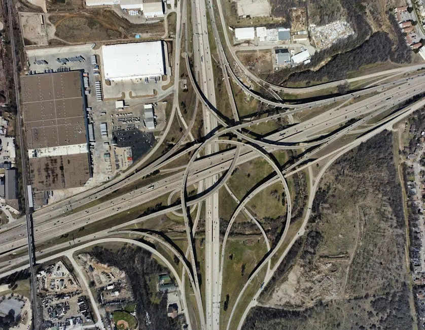
Understanding how GIS maps can provide insights into CBSAs is crucial for effective analysis. core-based statistical area gis map


All images from Pexels