Introduction
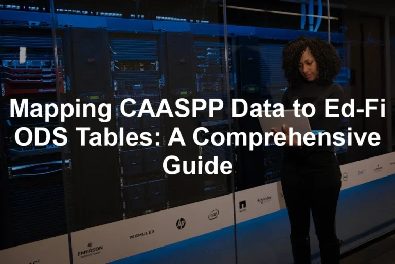
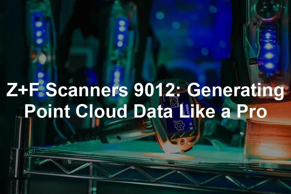
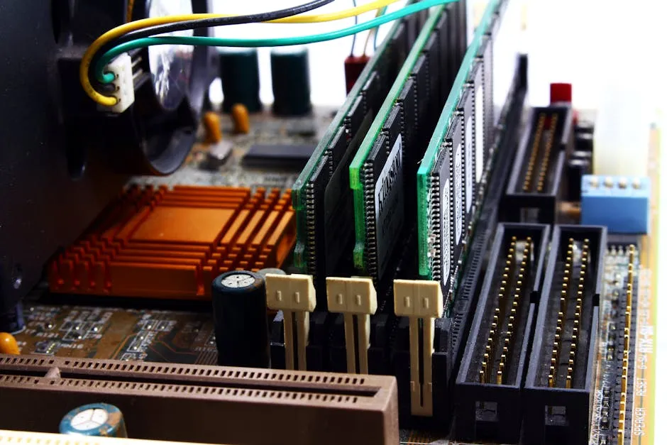
In the fascinating universe of 3D mapping and modeling, laser scanners are the unsung heroes that transform the ordinary into the extraordinary. Among these marvels is the Z+F PROFILER® 9012, a 2D laser scanner that boasts the ability to generate precise point cloud data at lightning speed. Imagine capturing a bustling cityscape in mere minutes while ensuring every detail is accounted for—this is the magic of the Z+F PROFILER® 9012.
This remarkable device offers incredible speed, scanning over 1 million points per second. It doesn’t just take pictures; it captures the essence of an environment, creating a detailed map that’s accurate down to the last millimeter. Your smartphone camera might snap a photo, but the Z+F 9012 paints a picture in three dimensions, collecting data that can be used for everything from urban planning to heritage documentation.
One of the standout features of the Z+F PROFILER® 9012 is its versatility. It’s built to handle a variety of conditions, making it ideal for diverse applications. Whether you’re surveying a construction site or analyzing historical landmarks, this scanner is designed to meet your needs.
What sets the Z+F PROFILER® 9012 apart is not just its speed and precision, but also its user-friendly design. Even if you’re not a tech wizard, you can navigate its features with ease. The integration of Z+F SynCaT® software further enhances the scanner’s capabilities, allowing users to synchronize and calibrate data effectively.
In this article, we will explore the features, functionalities, and applications of this remarkable tool, all while equipping you with the knowledge to generate point cloud data like a pro. Buckle up, because the journey into the world of laser scanning is about to get exciting! Get ready to embrace the future of data collection and discover how the Z+F PROFILER® 9012 can revolutionize your projects.

Understanding Point Cloud Data
What is Point Cloud Data?
Point cloud data consists of a collection of points in a three-dimensional space. Each point represents a precise location on the surface of an object or within an environment. These data points are often produced by 3D scanning technologies, such as laser scanners or photogrammetry systems. Each point is defined by its X, Y, and Z coordinates, allowing for a detailed representation of the scanned surface.
Why is this important? Well, point clouds serve as the backbone of 3D modeling. They enable architects, engineers, and designers to create accurate digital models of real-world environments. Imagine building a virtual replica of a historic castle or the intricate details of a cityscape. Point clouds make this possible. They capture every nook and cranny, providing a foundation for subsequent modeling and analysis.
Point cloud data is also essential for visualizing complex structures. It allows for better decision-making in various fields, including construction, urban planning, and environmental assessments. The detail and accuracy provided by point clouds help professionals assess conditions, plan projects, and visualize outcomes effectively.
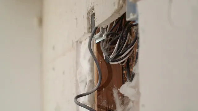
Generating point cloud data involves using advanced scanning technology. Laser scanners, like the Z+F PROFILER® 9012, play a pivotal role in this process. These scanners emit laser beams that bounce off surfaces, measuring the time it takes for the light to return. This time-of-flight measurement helps determine the distance to each point, creating a precise 3D map.
The process is rapid and efficient. Modern scanners can capture over 1 million points per second, producing dense point clouds in no time. This capability is particularly beneficial for capturing large areas or intricate details in complex environments. The Z+F PROFILER® 9012 stands out for its high speed and accuracy, ensuring that even fast-moving projects can benefit from high-quality data collection.

Understanding the significance of point cloud data is crucial for various applications, especially in urban planning. Explore how data visualization techniques can aid in employment statistics analysis.
Applications of Point Cloud Data
Point cloud data finds extensive applications across various industries, notably in architecture, engineering, and construction (AEC). In these fields, point clouds are used to create detailed models that guide project design and execution. Architects can visualize their concepts in 3D, identifying potential issues before construction begins. Engineers benefit from precise measurements, ensuring that every element fits perfectly within the design.
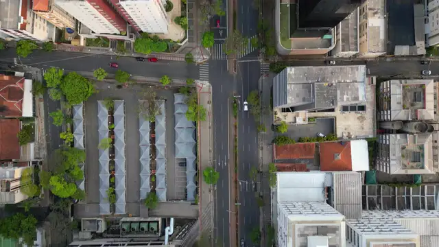
Urban planning is another area where point clouds shine. City planners utilize point cloud data to analyze existing infrastructure, assess environmental impacts, and plan new developments. By having an accurate representation of the urban landscape, they can make informed decisions that benefit communities.
Environmental monitoring also leverages point cloud data. Researchers can track changes in landscapes, such as erosion or deforestation, by comparing point clouds over time. This data aids in conservation efforts and helps stakeholders understand the implications of environmental changes.
In summary, point cloud data is a game-changer. Its applications span across industries, enhancing accuracy, efficiency, and visualization capabilities. As technology continues to evolve, the use of point clouds will only expand, paving the way for more innovative solutions and insights.
User-Friendly Design
The Z+F PROFILER® 9012 excels in user-friendliness. It’s designed for everyone—professionals, hobbyists, and the tech-challenged. The intuitive interface makes navigating through various features a breeze. No need for a PhD in engineering here!
Portability is another feather in its cap. Weighing in at a manageable size, this scanner can go wherever your projects take you. Whether you’re scaling a mountain or surveying a construction site, its lightweight design ensures ease of transport. Plus, setup is quick. You can be scanning in no time, which means more data collection and less fiddling with equipment.
If you need to ensure your projects are backed up and secure, consider investing in a Portable External Hard Drive. It’s the perfect companion for keeping your data safe and sound, especially when you’re on the go!

Robust Data Accuracy
When it comes to data accuracy, the Z+F PROFILER® 9012 is a heavyweight champion. With its advanced laser technology, it guarantees high precision in data collection. This isn’t just a “good enough” scenario—this scanner delivers results that are spot-on.
Why does accuracy matter? In fields like surveying and mapping, precision is everything. A single miscalculation can lead to costly mistakes, right? Whether you’re measuring land for a new building or creating a detailed map, having accurate data is crucial. The Z+F PROFILER® 9012 ensures you get that level of accuracy, making it a reliable choice for professionals who can’t afford to miss a beat.
If you’re looking to enhance your modeling capabilities, consider using 3D Modeling Software like Blender. It’s a fantastic tool to bring your point cloud data to life with stunning visualizations!

Z+F SynCaT® Software Overview
Introduction to Z+F SynCaT®
The Z+F SynCaT® software serves as a powerful companion to the Z+F PROFILER® 9012. It connects the scanner with external navigation systems, creating an efficient workflow. Imagine a smooth orchestra where everything plays in perfect harmony—that’s SynCaT® for your data collection.
This software isn’t just about connecting dots; it enhances your scanning experience. SynCaT® processes calibration parameters and ensures that data is synchronized seamlessly. It’s like having a personal assistant who never gets tired of organizing your data!
To further improve your workflow, a High-Performance Laptop for Data Processing can be a game changer. It will help you manage and process your data efficiently without any hiccups!
Key Features of Z+F SynCaT®
What makes SynCaT® stand out? Let’s break it down:
- Calibration: Adjusts calibration parameters for different system integrations. It accounts for translation and rotation offsets, ensuring accurate results no matter the setup.
- Synchronization: Combines data from the Z+F PROFILER® 9012 with trajectory data. This process generates 3D point cloud files that reflect the real environment perfectly.
- Transformation: Converts 3D point cloud data into various local coordinate systems. It also applies height correction models, so you can be sure your data is as precise as a Swiss watch.
- Correction: Estimates offsets based on predefined ground control points (GCPs). This feature adds an extra layer of accuracy, ensuring your data is trustworthy.
SynCaT® is modular, allowing users to customize their software package. This flexibility caters to the unique needs of different projects, making it an excellent tool for any user.
Case Study: Real-World Application
Let’s paint a picture with a real-world case study. Consider a city planning project where the Z+F PROFILER® 9012 and SynCaT® were used to map a complex urban landscape. The team faced challenges with varying elevations and intricate structures.
With SynCaT®, they synchronized the scanner with GPS data, capturing an accurate representation of the city. The calibration features helped address discrepancies in elevation, while transformation capabilities ensured all data fit into the required coordinate systems. The result? A detailed, accurate 3D model that facilitated informed decision-making for city planners.
This case illustrates how the Z+F SynCaT® software maximizes the potential of the Z+F PROFILER® 9012. Together, they create a formidable duo that transforms data collection from a daunting task into a streamlined process. With user-friendly design and robust performance, they pave the way for accurate and effective mapping solutions.
Real-World Applications
Urban Planning
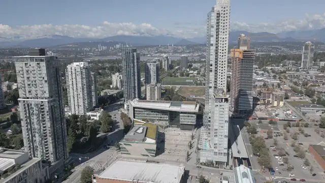
The Z+F PROFILER® 9012 is a powerful ally in urban development projects. Imagine a bustling city, full of life, where every street, building, and park needs careful planning. The scanner provides detailed point cloud data that helps city planners visualize their designs in three dimensions.
With its impressive scanning speed, the Z+F PROFILER® 9012 can capture vast areas in a fraction of the time compared to traditional methods. This efficiency is crucial when planning new infrastructures, like roads or bridges, where every detail matters. The scanner allows planners to assess how new developments affect existing structures and environments.
Moreover, accurate point cloud data helps identify potential issues before construction begins. Planners can simulate different scenarios, analyzing sunlight exposure or flood risks. This foresight minimizes costly changes later on. Thanks to the Z+F PROFILER® 9012, cities can grow smarter, safer, and more sustainable.
For those looking to enhance their surveying capabilities, a Laser Distance Measure Tool can be invaluable. It ensures precise measurements that complement the data collected by the scanner.
Forensics
In the realm of forensics, precision is paramount. The Z+F PROFILER® 9012 excels in capturing crime scenes with unparalleled accuracy. Law enforcement agencies rely on this technology to create detailed, three-dimensional representations of crime scenes.
Point cloud data generated by the scanner allows investigators to analyze evidence from multiple angles. This capability is invaluable in reconstructing events, ensuring that no detail goes unnoticed. For example, the software can visualize bullet trajectories, helping to determine the sequence of events.
Moreover, the high level of detail captured can be utilized in court presentations. Jurors can see the crime scene exactly as it was, enhancing their understanding of the case. By providing accurate and reliable data, the Z+F PROFILER® 9012 strengthens the foundation of forensic investigations.

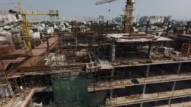
Infrastructure Monitoring
Ongoing infrastructure assessments are essential for maintaining safety and functionality. The Z+F PROFILER® 9012 plays a vital role in monitoring the condition of bridges, roads, and other critical structures. By generating point cloud data, it enables engineers to detect potential issues before they escalate.
Using the scanner, engineers can regularly assess wear and tear on infrastructure. The detailed data allows for precise measurements of deformation or structural changes over time. This proactive approach helps extend the lifespan of assets and prevent costly repairs.
Additionally, the scanner’s all-weather capabilities mean that assessments can occur year-round. Whether it’s rain or shine, the Z+F PROFILER® 9012 delivers consistent performance. This reliability is essential for infrastructure monitoring, ensuring that public safety remains a top priority.
To keep your equipment safe while on the field, a Waterproof Backpack for Equipment is a must-have. It protects your gear from the elements while keeping it organized and accessible!
Future Trends in Laser Scanning Technology
Emerging Technologies
Laser scanning technology is on the cusp of exciting advancements. Innovations in artificial intelligence and machine learning are set to revolutionize point cloud generation. These technologies will enhance data processing, making it faster and more efficient. Imagine a scanner that not only captures data but also analyzes it in real-time!
Predictions suggest that future scanners will integrate advanced algorithms that can automatically identify objects and features within point clouds. This capability will streamline workflows and reduce the burden of manual data processing. As a result, professionals can focus more on analysis and decision-making rather than data collection.
Moreover, advancements in sensor technology will likely lead to even higher scanning speeds and improved accuracy. The future of point cloud generation looks bright, with endless possibilities for enhancing various industries.
If you’re looking to visualize your data in a more immersive way, consider a VR Headset for 3D Visualization. It can take your presentations to the next level by allowing clients to experience projects in a virtual environment!
Integration with Other Technologies
The Z+F PROFILER® 9012’s evolution may see it integrating seamlessly with other technologies. As smart cities and the Internet of Things (IoT) gain traction, the scanner could become a critical component in data ecosystems.
Imagine a future where laser scanners work alongside drones or mobile mapping systems. This collaboration could provide comprehensive data sets that enrich urban planning, infrastructure monitoring, and environmental assessments.
Furthermore, the combination of laser scanning with data analytics platforms can yield powerful insights. By harnessing big data, professionals can make informed decisions that drive progress across various sectors. The integration of these technologies will shape the future of point cloud generation, making it an essential tool in modern workflows.
Integration with Other Technologies
The Z+F PROFILER® 9012 is not just a scanner; it’s a gateway to the future! Imagine combining this powerhouse with artificial intelligence (AI) and machine learning. This integration holds fascinating potential for enhancing data collection and analysis.
AI could revolutionize point cloud data processing. Picture algorithms that automatically identify features within the data. This means less manual labor for users and quicker insights. For instance, AI could instantly detect irregularities in infrastructure, alerting engineers before issues escalate. Talk about a proactive approach!
Machine learning can take this a step further. By analyzing historical data, it can predict future trends. Imagine a scenario where the scanner learns from past projects. The next time it captures data, it can optimize the process based on previous experiences. Efficiency? Check!
Moreover, with advancements in data visualization technologies, point clouds from the Z+F PROFILER® 9012 may be transformed into interactive 3D models. These models could be explored in virtual reality (VR), allowing stakeholders to “walk through” projects before they even break ground. This immersive experience will enhance project planning and client presentations.
As these technologies converge, the Z+F PROFILER® 9012 will remain at the forefront. Its role will evolve from simply capturing data to being an integral component of a smart, connected ecosystem. The future of point cloud generation is not just bright; it’s dazzling!

FAQs
What industries use point cloud data?
Point cloud data is widely utilized across several industries. In architecture, it aids in design precision and visualization. Engineers leverage it for infrastructure assessments and safety evaluations. Urban planners employ point clouds to analyze existing structures and plan new developments. Environmental scientists use this data for monitoring changes in landscapes, while forensic experts rely on it to recreate crime scenes with high accuracy. Overall, point cloud data is an invaluable resource across multiple sectors, enhancing decision-making and project outcomes.
How does the Z+F PROFILER® 9012 compare to other scanners?
The Z+F PROFILER® 9012 stands out due to its impressive scanning speed, exceeding 1 million points per second. This speed is coupled with a maximum range of 119 meters, making it suitable for a variety of applications. Other scanners may offer similar features, but few can match the combination of speed, precision, and user-friendly design found in the Z+F PROFILER® 9012. Its robust data accuracy and all-weather capabilities further distinguish it from competitors.
Can I use the scanner in different weather conditions?
Absolutely! The Z+F PROFILER® 9012 is designed with versatility in mind. It boasts an IP 54 rating, making it dust and splash-proof. This means you can confidently operate the scanner in various weather conditions, from light rain to dusty environments. Its operational temperature range of -10°C to +45°C ensures reliability, no matter the season. So go ahead, take it out in the field!
Is training required to operate the Z+F PROFILER® 9012?
While the Z+F PROFILER® 9012 is designed for user-friendliness, some training is recommended for optimal performance. Zoller+Fröhlich provides comprehensive training resources and support to ensure users can operate the scanner effectively. Familiarizing yourself with the Z+F SynCaT® software is also beneficial, as it enhances the scanner’s capabilities. With a little practice, you’ll be scanning like a pro in no time!
For those who enjoy documenting their journeys, a Field Notebook for Surveying is essential. It allows you to jot down important observations and data on-site, ensuring nothing is overlooked!
Please let us know what you think about our content by leaving a comment down below!
Thank you for reading till here 🙂
All images from Pexels